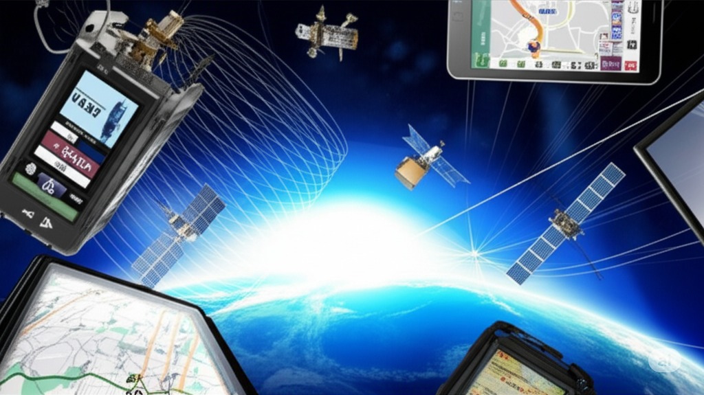
How GPS Fleet Management Systems Work: Technology and Process Explained

GPS fleet management systems combine satellite technology, cellular networks, and software platforms to enable vehicle tracking and fleet optimization. These systems process real-time data to provide insights for fleet operations.

GPS Technology Fundamentals in Fleet Management

GPS satellites orbit Earth at an altitude of 20,200 kilometers. Each satellite broadcasts precise time and position signals continuously. Fleet tracking devices receive these signals from multiple satellites simultaneously to determine exact vehicle locations through trilateration calculations.

Satellite Technology Features

  • 24 operational GPS satellites in orbit
  • Multi-constellation support (GPS, GLONASS, Galileo)
  • Position accuracy within 3-5 meters
  • Signal processing algorithms filter interference
  • Trilateration calculations determine exact locations
  • Continuous signal broadcasting 24/7
  • Advanced receivers compensate for signal degradation
Modern GPS fleet tracking systems utilize signals from multiple GNSS networks to improve accuracy and reliability in challenging environments.
GPS satellite network communicating with fleet vehicles

Core Components of GPS Fleet Management Systems

Vehicle tracking devices connect through standardized OBD-II ports. The hardware includes GPS receivers, cellular modems, and microprocessors in a single unit. These components work together to collect and transmit location and vehicle data.

Fleet tracking device components and installation

Hardware Components

  • GPS receivers for satellite signal processing
  • Cellular modems for data transmission
  • Microprocessors for real-time data processing
  • OBD-II port connections for vehicle diagnostics
  • Internal backup batteries for continuous operation
  • Antenna systems for optimal signal reception
  • Power management circuits for system protection
Installation requires strategic placement of antennas for optimal signal reception while power management circuits protect vehicle electrical systems.

GPS Data Collection and Transmission Process

Vehicle sensors collect multiple data points every second. The system records location coordinates, speed, heading, and timestamps. Engine diagnostic data flows through the OBD-II port connection. Additional sensors monitor vehicle status, cargo conditions, and driver behavior patterns.

Data Collection Methods

  • Location coordinates recorded every 30-60 seconds
  • Speed and heading data from GPS calculations
  • Engine diagnostic information via OBD-II
  • Sensor data for vehicle status monitoring
  • Driver behavior pattern analysis
  • Data compression to minimize bandwidth usage
  • Local storage during network outages
Data packets combine GPS coordinates with vehicle telemetry and transmission occurs at configurable intervals through cellular networks.
Fleet tracking data collection and transmission process

Cellular and Network Connectivity in Fleet Systems

Modern fleet tracking systems utilize 4G/5G cellular networks. Data transmission occurs through secure TCP/IP protocols. The system maintains continuous connectivity through multiple cellular carriers. Automatic carrier switching prevents coverage gaps during vehicle movement.

Fleet management cellular network connectivity

Network Features

  • 4G/5G cellular network connectivity
  • Secure TCP/IP data transmission protocols
  • Multiple cellular carrier support
  • Automatic carrier switching for coverage
  • SSL/TLS encryption for data security
  • Backup satellite communication options
  • Network monitoring and quality assurance
Encryption protocols protect data during transmission while multiple authentication layers prevent unauthorized access to fleet data.

Real-Time Tracking and Location Services

GPS tracking systems update vehicle locations every 30-60 seconds. Digital maps display real-time position data for entire fleets. Geographic information systems overlay additional data layers for route analysis. Map interfaces show vehicle status, direction, and speed.

Tracking Capabilities

  • Real-time location updates every 30-60 seconds
  • Digital map displays with fleet overview
  • Geofencing technology for virtual boundaries
  • Location history and route replay features
  • Traffic data integration for route optimization
  • Automated alerts for events and violations
  • Speed monitoring and idle time tracking
Geofencing technology creates virtual boundaries on maps while the system generates alerts when vehicles enter or exit defined zones.
Fleet management real-time tracking dashboard

Fleet Management Software and Cloud Platforms

Cloud platforms store and process fleet tracking data. Distributed databases handle millions of daily location updates. Load balancing ensures consistent system performance. Redundant servers maintain 99.9% uptime for critical operations.

Fleet management software cloud architecture

Platform Features

  • Cloud-based data storage and processing
  • Distributed databases for scalability
  • Load balancing for consistent performance
  • 99.9% uptime with redundant servers
  • Web interfaces for fleet management tools
  • Role-based permissions and access control
  • Multi-tenant architecture for data security
Web interfaces provide access to fleet management tools while role-based permissions control feature access levels.

Data Processing and Analytics in GPS Fleet Systems

Advanced algorithms process raw GPS and vehicle data. Machine learning models identify patterns in fleet operations. Route optimization calculations consider multiple variables including traffic, distance, and delivery windows. The system generates performance metrics for vehicles and drivers.

Analytics Capabilities

  • Advanced algorithms for data processing
  • Machine learning pattern identification
  • Route optimization with multiple variables
  • Performance metrics for vehicles and drivers
  • Predictive analytics for maintenance needs
  • Business intelligence visualization tools
  • Custom KPI dashboards and reporting
Predictive analytics forecast maintenance needs while data filtering removes anomalies and incorrect readings.
Fleet management data processing and analytics workflow

Mobile Applications and User Interface Technology

Mobile apps provide fleet data access on smartphones and tablets. Driver apps include navigation and job assignment features. Manager interfaces display fleet overview dashboards. Push notifications alert users to critical events.

Fleet tracking mobile application interface

Mobile Features

  • Smartphone and tablet fleet data access
  • Driver apps with navigation and job assignment
  • Manager dashboards for fleet overview
  • Push notifications for critical events
  • Offline functionality without cellular coverage
  • Touch-optimized controls for mobile interaction
  • Real-time communication between drivers and dispatchers
Offline functionality enables app use without cellular coverage while data synchronization occurs automatically when connectivity returns.

Integration and Communication with Other Systems

API connections enable data exchange with external systems. Standard protocols support integration with ERP software. Fleet management systems connect to fuel card networks for automated expense tracking. Dispatch software interfaces streamline job assignment and routing.

Integration Capabilities

  • API connections for external system integration
  • ERP software integration with standard protocols
  • Fuel card network connections for expense tracking
  • Dispatch software interfaces for job management
  • Maintenance system automated diagnostic alerts
  • Custom APIs for specialized system connections
  • Real-time synchronization between integrated systems
Maintenance systems receive automated diagnostic alerts while integration modules connect with third-party applications.
Fleet management system integration architecture

Frequently Asked Questions

  • How do GPS fleet management systems work?

    GPS fleet management systems use satellite signals to determine vehicle locations. Tracking devices collect and transmit position data through cellular networks. Cloud servers process this information for real-time fleet monitoring.

  • What technology is used in GPS fleet management systems?

    The systems combine GPS receivers, cellular modems, and onboard sensors. Cloud computing platforms process the data. Mobile applications provide user access to fleet information.

  • How does GPS tracking work in fleet management?

    Vehicle-mounted devices receive signals from GPS satellites. Position calculations occur through trilateration. The system transmits location data to central servers every 30-60 seconds.

  • What are the components of a GPS fleet management system?

    Core components include vehicle tracking devices, cellular communication modules, cloud servers, and user interfaces. Additional elements include sensors, antennas, and power management systems.

  • How do GPS fleet management systems communicate with vehicles?

    Communication occurs through cellular networks using 4G/5G technology. Backup systems ensure continuous connectivity. Encryption protocols secure all data transmission.

Understanding GPS Fleet Management Technology

GPS fleet management systems represent an integration of multiple technologies. Satellite positioning combines with cellular communications and cloud computing. The resulting system provides comprehensive fleet monitoring and management capabilities.

Complete GPS fleet management system overview

Technology Integration Benefits

  • Satellite positioning for accurate vehicle tracking
  • Cellular networks enable real-time data transmission
  • Cloud platforms provide scalable data processing
  • Mobile applications offer flexible user access
  • Integration capabilities extend system functionality
  • Analytics transform data into actionable insights
System architecture ensures reliable data flow from vehicles to users while security measures protect sensitive fleet information and scalable platforms adapt to changing requirements.

Key Takeaways

  • GPS satellites provide continuous vehicle positioning
  • Cellular networks enable real-time data transmission
  • Cloud platforms process and store fleet data
  • Multiple protocols ensure system connectivity
  • Integration capabilities extend system functionality
  • Analytics transform data into actionable information
  • Mobile applications provide flexible user access
  • Security measures protect sensitive fleet data