GPS Satellites: The Complete Guide to Global Navigation Satellite Systems

GPS satellite technology powers global positioning in 2025. The system consists of constellation architecture, orbital mechanics, signal transmission, and accuracy factors that enable modern navigation and location services.

Introduction to GPS Satellites and Navigation Systems

GPS satellites originated in 1973 through U.S. military development. The system consists of 24 primary satellites orbiting at 20,200 kilometers above Earth. These satellites transmit precise time and position data to receivers worldwide.

GPS Satellite System Fundamentals

  • Basic principles involve triangulation using multiple satellite signals
  • Each satellite broadcasts its position and time using atomic clocks
  • Ground receivers calculate their position by measuring signal travel time
  • Military applications require encrypted signals for precision guidance
  • Civilian uses span navigation, surveying, and timing services
The system architecture includes space, control, and user segments working in coordination to provide accurate positioning services globally.
Fleet tracking devices receiving GPS signals for enhanced productivity and dispatch operations
GPS satellite system overview showing the fundamental components of global positioning technology

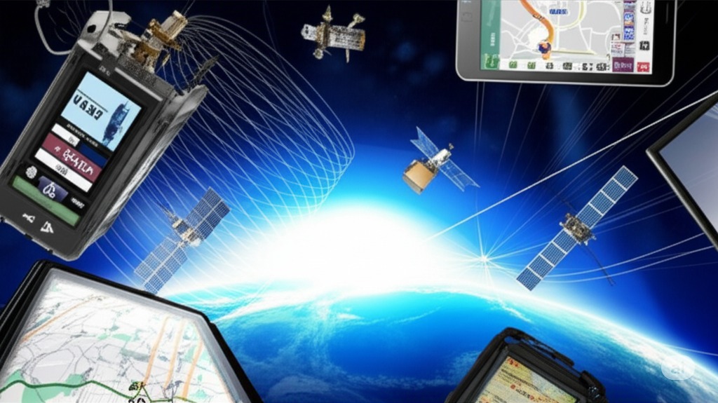
GPS Satellite Constellation Architecture

The GPS constellation maintains 24 operational satellites in six orbital planes. Each plane contains four satellites spaced 60 degrees apart. This configuration ensures at least four satellites remain visible from any point on Earth.

GPS tracking system showing fleet management capabilities through satellite constellation coverage
GPS satellite constellation architecture demonstrating global coverage patterns and orbital mechanics

Constellation Design and Structure

  • Satellites orbit at 20,200 kilometers altitude with a 12-hour period
  • The constellation requires periodic updates through replacement launches
  • Each satellite undergoes regular maintenance and position adjustments
  • Block generations mark technological evolution
  • Current Block III satellites offer improved accuracy and signal strength
The system includes backup satellites for redundancy and maintenance coverage, ensuring continuous global positioning services.

How GPS Satellites Work: Signal Transmission and Reception

GPS satellites broadcast radio signals containing precise time and position data. Each satellite carries multiple atomic clocks that maintain time accuracy to within billionths of a second. The signals travel at the speed of light to reach Earth-based receivers.

Signal Processing and Reception

  • Time synchronization between satellites occurs through ground control stations
  • Stations monitor satellite atomic clock performance and apply corrections
  • Each satellite broadcasts its precise location and time information every second
  • Signal propagation follows defined paths through the atmosphere
  • Trilateration methods determine location by measuring distances from multiple satellites
Receivers track multiple satellites simultaneously, involving signal acquisition and lock maintenance with Doppler effect corrections for satellite motion.
GPS fleet tracking system showing signal transmission for efficient fleet management and dispatch operations
GPS satellite signal transmission process showing how positioning data reaches ground receivers

GPS Satellite Orbital Mechanics and Positioning

GPS satellites operate in Medium Earth Orbit at 20,200 kilometers altitude. Each satellite completes two orbits per day. The orbital period maintains consistent ground coverage patterns.

Fleet tracking system visualization of GPS satellite orbits for enhanced fleet management
GPS satellite orbital mechanics showing Medium Earth Orbit patterns and positioning systems

Orbital Parameters and Maintenance

  • Satellite orbits follow specific inclination angles of 55 degrees
  • This inclination provides optimal coverage for most populated areas
  • Ground stations monitor orbital parameters and track satellite positions continuously
  • Orbital perturbations affect satellite positions over time
  • Station-keeping maneuvers correct deviations to maintain precise positioning
Launch vehicles place satellites into transfer orbits, then move to designated positions with proper spacing between satellites in each orbital plane.

Global Navigation Satellite Systems (GNSS) Overview

Multiple satellite navigation systems operate worldwide. The United States GPS system maintains 31 operational satellites. Russia's GLONASS constellation consists of 24 satellites in three orbital planes.

Global GNSS Systems

  • The European Union's Galileo system deploys 30 satellites
  • China's BeiDou system operates 35 satellites in various orbits
  • Regional augmentation systems supplement global constellations
  • WAAS serves North America with two geostationary satellites
  • Multi-constellation receivers track signals from multiple systems simultaneously
This capability enhances position accuracy and reliability through standard protocols ensuring compatibility between different satellite systems.

GPS Satellite Signal Structure and Components

GPS satellites transmit signals on multiple frequency bands. The L1 band carries civilian signals at 1575.42 MHz. L2 signals operate at 1227.60 MHz, while L5 broadcasts at 1176.45 MHz.

GPS fleet tracking signal analysis for precise fleet management and dispatch operations
GPS satellite signal structure showing frequency bands and data components

Signal Components and Modulation

  • The Coarse Acquisition code provides basic positioning capability
  • Military users access the encrypted Precision code for enhanced accuracy
  • Navigation messages contain satellite orbit and clock data
  • Satellites broadcast health status continuously
  • Signal modulation techniques protect against interference
Error correction methods ensure data integrity while the signal structure enables receivers to extract timing and position information.

Factors Affecting GPS Satellite Signal Accuracy

Atmospheric conditions affect GPS signal transmission significantly. The ionosphere delays signals by 5 to 15 meters. Tropospheric effects add 0.5 to 5 meters of error. These delays vary with satellite elevation angles and atmospheric conditions.

Signal Accuracy Challenges

  • Multipath interference occurs when signals reflect off buildings or terrain
  • Urban environments particularly suffer from multipath effects
  • Satellite geometry affects position accuracy through dilution of precision
  • Widely spaced satellites provide better geometric solutions
  • Weather conditions minimally affect GPS signals
Solar activity can disrupt ionospheric conditions and affect signal propagation, while urban canyons block satellite visibility in cities.
Fleet tracking system accuracy analysis for optimal fleet management and alerts
GPS signal accuracy factors showing atmospheric effects and error sources

Modern GPS Satellite Technology and Innovations

GPS III satellites introduce significant improvements over previous generations. Signal power increases by 8 times compared to GPS II satellites. Anti-jamming capabilities show 100-fold improvement through advanced electronics.

Advanced fleet tracking devices utilizing modern GPS technology for enhanced productivity
Modern GPS satellite technology showing advanced features and capabilities

Advanced GPS Technology

  • Atomic clock stability reaches 10^-15 seconds per day
  • This precision enables positioning accuracy within 1 meter
  • Advanced antenna designs direct more power toward Earth targets
  • Satellite-based augmentation systems provide real-time corrections
  • Cross-linking between satellites enables autonomous operation
Reduced ground station dependence improves system resilience while new signal structures enhance civilian and military capabilities.

Future of GPS Satellite Technology

Next-generation GPS satellites incorporate quantum timing technology. These innovations will improve accuracy to centimeter levels. New satellites will broadcast additional civilian signals.

Advanced fleet tracking technology utilizing next-generation GPS satellites for enhanced fleet management
Future GPS technology showing next-generation satellite capabilities and innovations

Future GPS Developments

  • Low Earth Orbit constellations promise reduced signal latency
  • These systems will complement existing GPS services
  • Increased satellite numbers will improve urban canyon coverage
  • Space-based PNT services expand beyond basic positioning
  • 5G integration enables enhanced urban positioning
IoT devices benefit from improved signal processing while new security measures protect against signal spoofing attempts.

Frequently Asked Questions

  • How many GPS satellites are currently in orbit?

    The GPS constellation maintains 31 operational satellites. Additional backup satellites remain in orbit for redundancy. The minimum requirement for global coverage requires 24 functioning satellites.

  • How do GPS satellites maintain precise timing?

    Each GPS satellite carries multiple atomic clocks. These clocks maintain accuracy to within billionths of a second. Ground stations monitor and correct clock errors daily.

  • What happens if GPS satellites fail?

    The constellation includes backup satellites. Failed satellites trigger automatic switching to backups. Ground control can reposition satellites to maintain coverage.

  • How long do GPS satellites last?

    GPS satellites operate for 10-12 years on average. Solar panels power the satellites continuously. Regular maintenance extends operational lifespans.

  • Can GPS satellites be jammed?

    Signal jamming affects GPS reception locally. Modern satellites incorporate anti-jamming technology. Military signals resist interference more effectively than civilian signals.

Key Takeaways

  • GPS satellite technology fundamentally changes modern navigation with 31 satellites providing continuous global coverage
  • Atomic clock precision enables accurate positioning with clocks maintaining time to within billionths of a second
  • Multiple GNSS systems enhance global coverage with independent yet complementary services
  • Signal structure innovations improve performance with new frequencies and signal types enhancing civilian capabilities
  • Orbital mechanics define system operation with satellite positions following precise mathematical patterns